Urban Boundaries
This data product is available through an annual data license
About
Dotlas maintains a comprehensive collection of meticulously self-curated urban boundary data across global markets. These boundaries define distinct neighborhoods and localities as precise polygon geometries, reflecting both official administrative divisions and locally recognized areas.
Urban boundaries can form the bedrock of spatial studies, providing the flexibility to run complex spatial joins to match locations, roads, markers, and other geospatial datasets aggregated by neighborhoods for enhanced insights.
Our boundary data is:
- Created through extensive collaboration with GIS experts and local specialists
- Updated either annually or semi-annually to ensure accuracy
- Available for custom market expansion upon request
This dataset is particularly valuable for the following use-cases:
- Market analysis and planning
- Service area optimization
- Location-based applications & Demographic studies
Each boundary is carefully validated to ensure it accurately represents real-world geographic divisions while accounting for local context and usage.
All vector-based geospatial formats are supported, so whether you're using cloud-native geospatial, or just want to load up the boundaries into ArcGIS or QGIS on your desktop, our boundaries have you covered.
Data Dictionary
All urban boundaries have the same schema, filterable by country, city or the name of the neighbourhood.
| Column Name | Data Type | Description |
|---|---|---|
| name | string |
Name of the neighbourhood or boundary |
| city | string |
City in which neighbourhood is located |
| geometry | string (geometry) |
Full geometry of the shape (Polygon in WKT format) |
| country | string |
Country in which the neighbourhood and city are located |
| neighbourhood_id | string |
Dotlas-assigned unique identifier for the associated neighbourhood across geographies |
| centroid_longitude | float |
Longitude value of the centroid location of the neighbourhood |
| centroid_latitude | float |
Latitude value of the centroid location of the neighbourhood |
Products
Don't see a listed country for which you require urban boundaries?
We're always expanding our library of off-the-shelf GIS products, but we might still be able to provision efforts to gather the necessary data and create a custom curation for your needs. Contact us for more details.
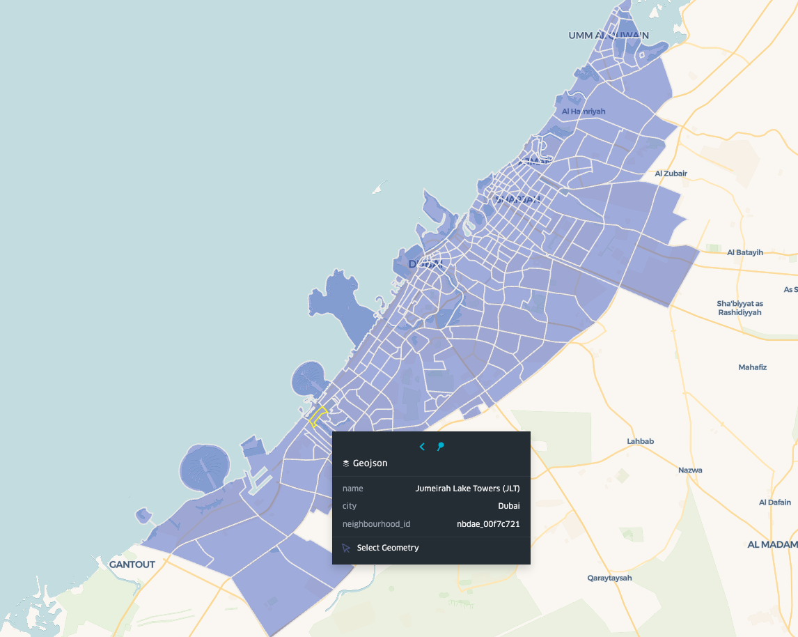
🇦🇪 United Arab Emirates
-
Neighbourhoods
Neighbourhood polygons including popular locations like Business Bay, Al Karama, JLT in Dubai.
-
Cities
City-wide polygons representing all major cities in the United Arab Emirates.
View Example Boundaries on the Map
Map indicates neighbourhood-level boundaries for Dubai, Sharjah, Ajman and Umm Al Quwain cities in the UAE.
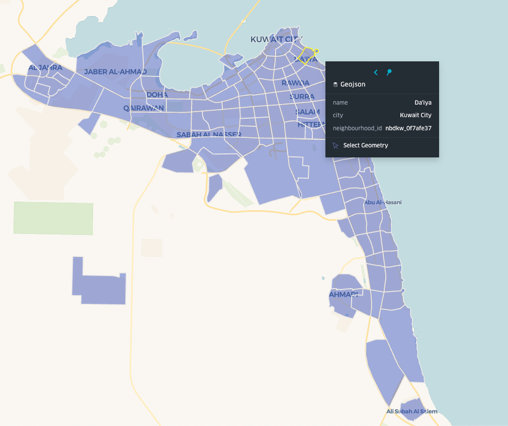
🇰🇼 Kuwait
-
Neighbourhoods
Neighbourhood polygons including prominent areas like Salmiya, Hawally, and Kuwait City's financial district.
-
Cities
City-wide polygons covering Kuwait's major urban areas including Kuwait City, Jahra, and Ahmadi.
View Example Boundaries on the Map
Map indicates neighbourhood-level boundaries for Kuwait.
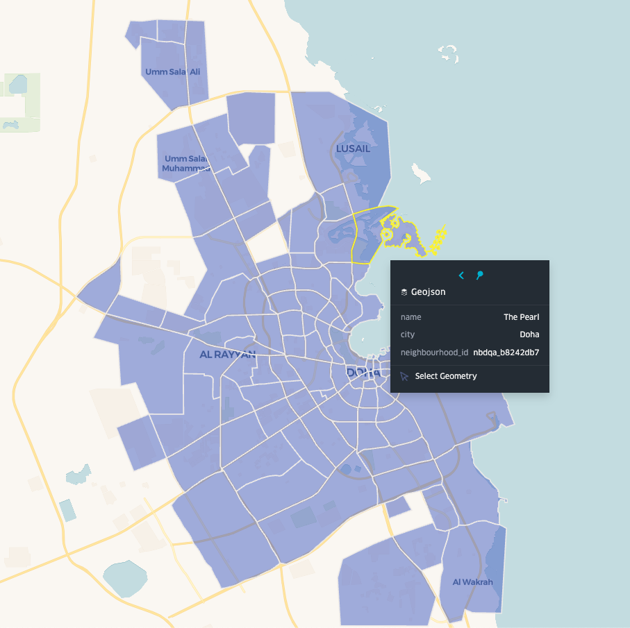
🇶🇦 Qatar
-
Neighbourhoods
Neighbourhood polygons including The Pearl, West Bay, Lusail, and other prominent Doha districts.
-
Cities
City-wide polygons encompassing Doha, Al Wakrah, Al Khor, and other major Qatari municipalities.
View Example Boundaries on the Map
Map indicates neighbourhood-level boundaries for Qatar (Doha / Lusail).
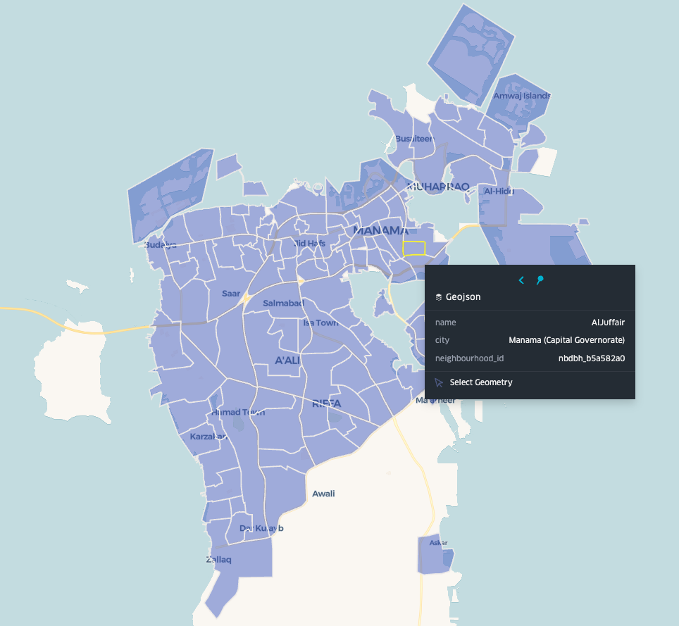
🇧🇭 Bahrain
-
Neighbourhoods
Neighbourhood polygons covering Seef, Juffair, Manama's Diplomatic Area, and other key districts.
-
Cities
City-wide polygons including Manama, Riffa, Muharraq, and other major urban centers.
View Example Boundaries on the Map
Map indicates neighbourhood-level boundaries for Bahrain (Manama and other Governorates).
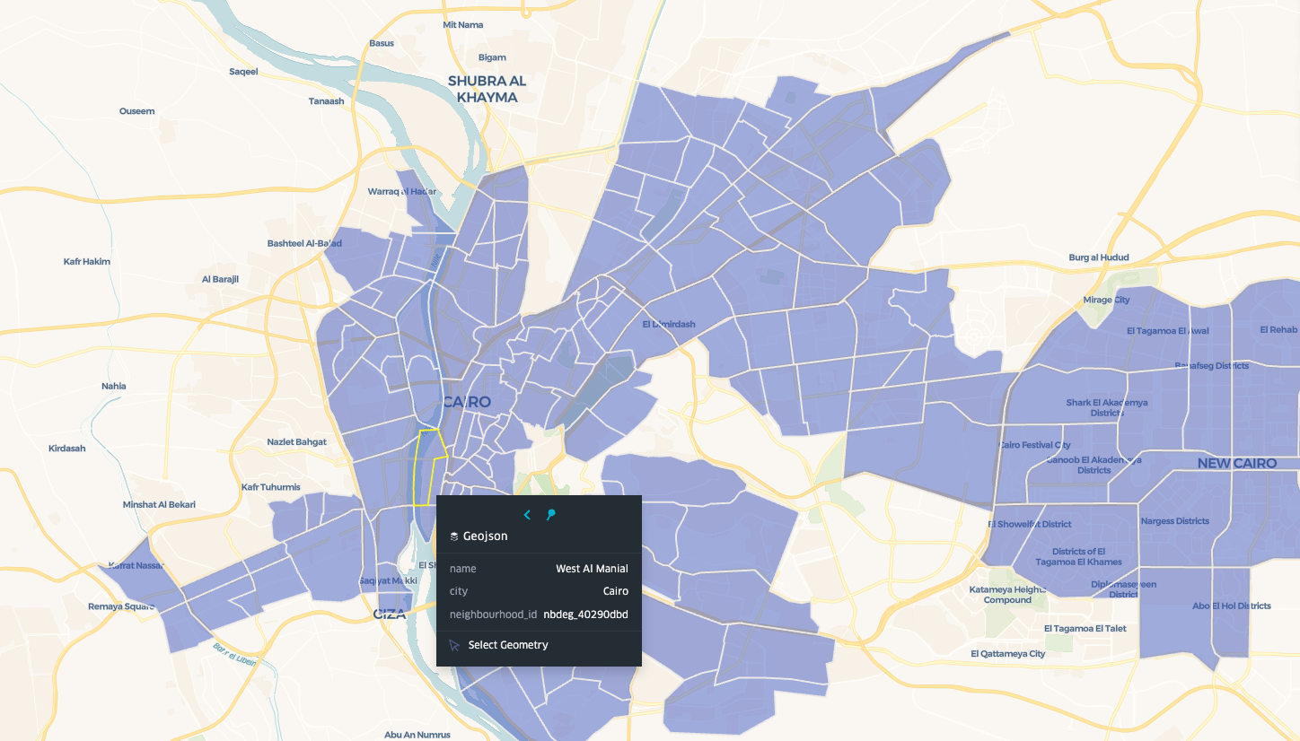
🇪🇬 Egypt
-
Neighbourhoods
Neighbourhood polygons including Zamalek, Maadi, Nasr City, and other vital Cairo districts.
-
Cities
City-wide polygons covering Cairo, Alexandria, Giza, and other major Egyptian cities.
View Example Boundaries on the Map
Map indicates neighbourhood-level boundaries for Cairo and parts of Giza.
🇴🇲 Oman
-
Neighbourhoods
Neighbourhood polygons including Qurum, Ruwi, Muttrah, and other key areas of Muscat.
-
Cities
City-wide polygons covering Muscat, Salalah, Sohar, and other major Omani cities.
View Example Boundaries on the Map
Map indicates neighbourhood-level boundaries for Muscat and parts of Seeb.

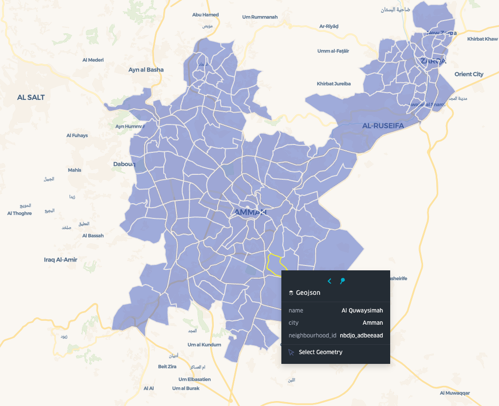
🇯🇴 Jordan
-
Neighbourhoods
Neighbourhood polygons including Abdoun, Sweifieh, Jabal Amman, and other prime Amman districts.
-
Cities
City-wide polygons includes Amman only.
View Example Boundaries on the Map
Map indicates neighbourhood-level boundaries for Amman.
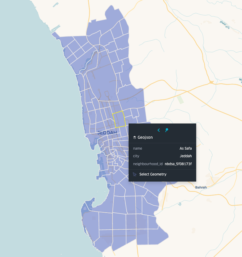
🇸🇦 Saudi Arabia
-
Neighbourhoods
Neighbourhood polygons including Al Olaya, Al Malaz, Al Muhammadiyah, and other key districts in major cities.
-
Cities
City-wide polygons covering Riyadh, Jeddah, Dammam, and other major Saudi cities.
View Example Boundaries on the Map
Map indicates neighbourhood-level boundaries for Jeddah.